|
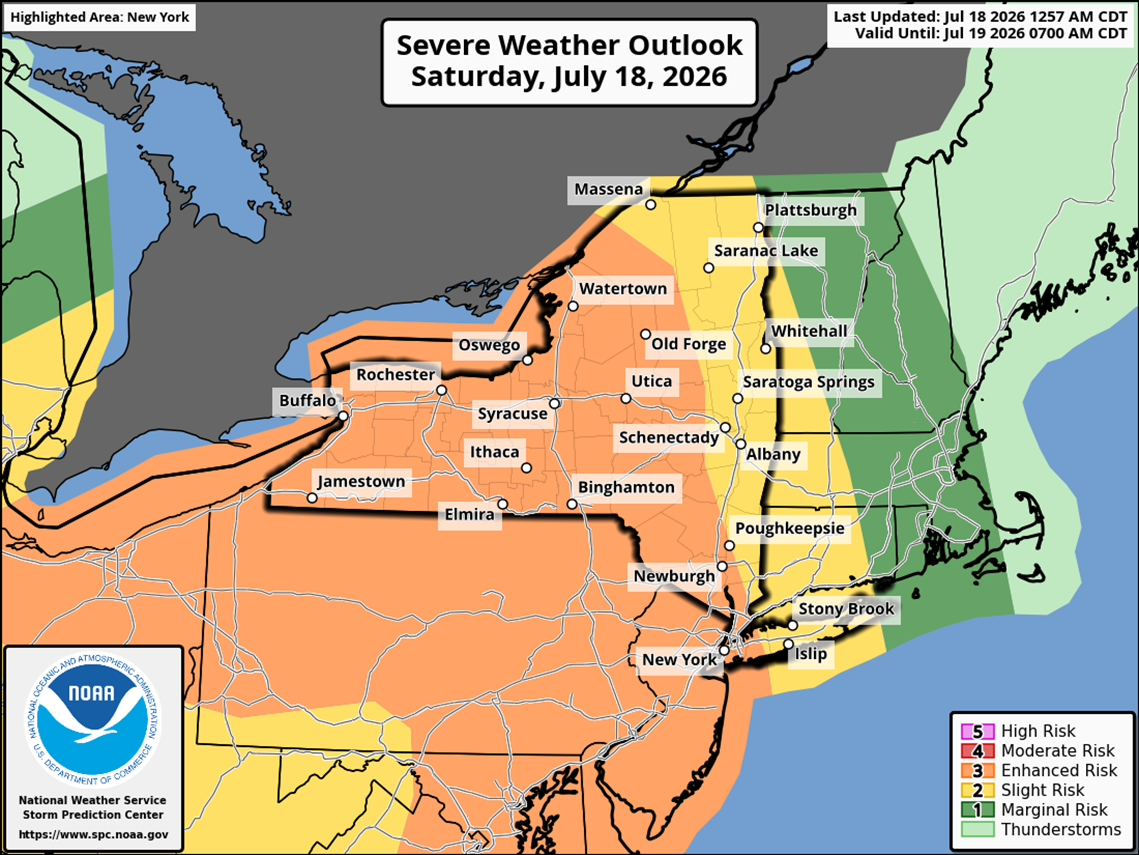
Enhanced Risk for Severe Thunderstorms Forecast for
Today
Published: July 18, 2026 at
08:30 a.m.
By: Notice from NYS
Office of Emergency Management
There is an
enhanced risk for severe thunderstorms in Albany, Dutchess, Franklin,
Fulton, Greene, Hamilton, Herkimer, Lewis, Montgomery, NYC, Nassau, Putnam,
Rockland, Schenectady, Schoharie, St. Lawrence, Ulster, and Westchester
Counties until July 19, 2026 at 7:00
a.m. Scattered to numerous sever storms
containing damaging winds, severe hail, and/or tornadoes may occur.
Flooding, high winds that blow objects around, downed trees, and power
outages will be possible.
The National
Weather Service may issue a weather watch or warning. A weather watch means BE
PREPARED - severe weather is possible. A warning means TAKE
ACTION - severe weather is expected.
- If you hear thunder, you are close enough to
the storm to be struck by lightning.
- Power surges may occur - avoid using
electrical appliances, such as air conditioners and washers.
- Avoid being outdoors. If you are stuck
outdoors, find a low spot away from trees, fences, and poles.
Driving through
thunderstorms can be dangerous:
- Keep both hands on the wheel in case of
sudden gusty winds.
- Slow down on wet pavement.
- Prepare for changing visibility due to heavy
rain.
- NEVER cross flooded roadways.
For more safety
tips visit: https://www.dhses.ny.gov/thunderstorm
Continue
monitoring updates to the forecast via local media or your nearest National
Weather Service Office by visiting www.weather.gov and search
for your zip code.
|